10.26.2014
The high road...
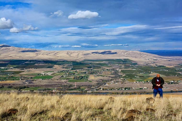
You'll see it south of the freeway between Prosser and Benton City. A road cut that goes from the valley floor up the side of the high ridge, angling ever-upwards, until it disappears over the top. The view north toward Rattlesnake Mountain is spectacular. What you don't see is the road continuing west along the back side of the ridge, looking south and east over the endless wheat fields of the Horse Heaven Hills, all the way to the wind farm above the Wallula Gap.
The views are well worth the drive, but they aren't the whole story. Keep on going west on the gravel road, and you can climb up a rough road to a nest of satellite dishes and radio towers at the highest point on the ridge. Park there and walk out to the edge, but carefully. From here, the Yakima River valley is spread out at your feet, and you can look east along the road cut and see the sheer basalt cliffs you just drove along. It's all quite spectacular, and worth the drive.
We didn't come up here for the view today. We came to grab the series of geocaches placed all along the road. It was cold and windy today, and a bit creepy in spots along the road. At one point I stayed behind while Dave climbed the hill to find a cache, and the wind blew so hard I could hear the gravel rattle as it blew down the road. I finally had to close my eyes... I could feel the sharp edges of vertigo every time the wind shook the Pilot.
It turned out to be my third best caching day: we found 100 caches. And as we inched down a very steep and rocky shortcut road back to pavement, I reached another milestone: my 3000th geocache find.
Subscribe to:
Post Comments (Atom)


Just came across your blog and it looks like we have similar interests - photography, hiking and blogging. I live in Portland, OR so we are almost neighbors! :) You can visit me at www.photomomlinda.blogspot.com
ReplyDeleteI'm so glad you stumbled across my blog, Linda... and appreciate that you left a comment and your blog address. I look forward to visiting it!
Delete