Showing posts with label Geocaching. Show all posts

12.31.2018

Eventing...

How do geocachers celebrate New Year's Eve? with lots and lots of geocaching events, that's how! Of all the events to choose from, we managed four:

Ring out the year with a kick = early morning coffee in Parkland
Thanks 2018, End of Year of the Dog = hot dogs at a cute little place near Green Lake


Did Love find 2018 caches in 2018? = mid-afternoon brew and conversation at Fremont Brewing
Say Goodbye to 2018 with the WSGA = a big party! Dinner and a glass of red with caching friends in Renton. After all the food today, my dinner was a yummy appetizer of Brussels sprouts.

12.29.2018

Really, really wet...

Heavy rains were predicted for today... bummer. Because we're going to Shelton for a geocaching event. Breakfast, then driving the back roads and logging roads, picking up geocaches along the way. And today, getting very, very wet.


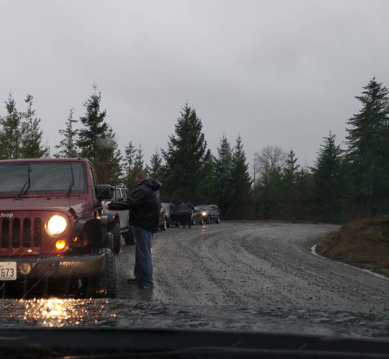
We did the route backwards, so it was a couple of hours before we started running into fellow cachers. Like at this remote location, south of Lake Cushman in the Olympics. Cold, windy, rainy... searching in the woods for the elusive geocache. Eight of us looked for this one with no luck. We went back to the Pilot, where I stayed. Wisely, I think. Everyone but us gave up and moved on, but DW thought he'd take another look just as another group arrived. And this time, he found it!

We stopped halfway through the route at a cache hidden deep inside a wrecked Model A (I made the find this time)... we were just outside a bakery, and were soaked and cold and needed a break. And hot coffee. And a big scoop of Olympic ice cream.

The day finished up at a local restaurant for dinner, and it was amusing to see the level of commitment of caching friends based on how wet they were. One gal made a beeline for Walmart to buy new clothes, then came to dinner. I was so glad we brought a complete change of clothes, from head to toe.


2.25.2018

Eye of the storm...

My niece told me about the ship bearing four new container cranes, due to arrive at the Port of Tacoma. And when we headed for the Port today, to do our daily geocache, I was hoping we'd get to see them. We drove into a thunderstorm, with black clouds and rain, but to the west the sun was shining on the Olympics. The wind was ice cold, and I wished I had brought my Nikon so I could have zoomed in on the ship. I can't imagine how this cargo, towering high above the deck, traveled all the way across the Pacific from China. The cranes, once installed, will be the biggest container cranes on the west coast: 434 feet tall with the booms raised.

2.20.2018

Walkers welcome here...

King County could learn a few tricks from Pierce County. The county trails near me have ugly stenciled mileage markers painted on the pavement, most of them gone and never repainted. In contrast, the Sumner Link trail system has these cool rusty metal signs.


We've spent a bit of time on this trail lately, to find our daily geocache. No one else has done these caches for a couple of months, wonder why?

12.30.2017

Grey day...


We wandered the back roads of Thurston county all day yesterday, looking for caches. And barns to come back and photograph, once the weather clears up a bit. Yesterday it was too soggy to even take my camera out of the Pilot.

This morning we went downstairs for coffee and food, waiting for our friends to arrive. It rained right up to 7:00 am, when the weather service predicted the rain would stop. And it did, right on time. Amazing.

It stayed gray most of the day, still, the time spent at the beach was great fun. By the end of the day, the six of us had found 44 caches and more than earned our Mexican dinner.


12.13.2017

Bumps in the road...

Our cache today was along a strip of abandoned road down in the valley. A stream runs along one side, and a row of cottonwood trees, with surface roots that have pushed up the roadway. I can see why the city gave up on maintaining this road, and chose to let nature take over.


Because of my recent run-in with autumn leaves hiding cracks in the sidewalk, I took this walk very carefully. It was like walking on a mini-roller coaster: up and down, up and down.


The reward for this bumpy walk turned out to be easy to find: a beautiful pine cone container that definitely didn't belong at the base of a cottonwood tree!


10.04.2017

Washington's oldest...

We've talked for years about going after the oldest geocache in Washington. We knew there was a steep hike involved, but with Indian summer in full swing, it seemed the perfect time to go.


Autumn is just starting to show its beautiful colors, especially the huckleberries, which are bright red. The vine maples are turning yellow and orange, and the trail is lined with them. It will be a beautiful hike.

We had the trail to ourselves, which suited me just fine. I take the accents at a measured pace, and stop often to look around. Because we came up for a drive in this area yesterday, I knew there were beautiful views to the south, and didn't want to miss any photographs of Mount Rainier.

Once we left the abandoned logging road and started to climb up through the forest, the colors intensified. We walked out into an old clear-cut and there, far below us, we saw Lake Keechelus.


When the trail climbed higher and veered to the west, there it was: Mount Rainier. The day was turning hazy in the late morning, with not much contrast. My eyes had no trouble, but I don't have much hope for good photographs.


After this lovely view, the trail turned north and headed deep into the forest. I was glad when we reached the top of the ridge, and the trail flattened out a bit. We're now on the narrow ridge that runs to Mt. Margaret, then down to Lake Lillian. And we're almost there. The cache is a short bushwhack up a steep hill and over deadfall trees. It was quite easy to find; the tough part was the hike in.


So here we are, three-quarters of the way up to Mount Margaret. Now what? We're so close, we couldn't resist climbing the rest of the way to the top. Where there is another geocache. And more views of Mount Rainier, 40 miles to the south.

So off we went. The trail was lovely, through towering trees and very little underbrush. It was like being in a cathedral. But the trail didn't take us to the top of the peak. Oh, no. We had to break off the main trail onto a very steep game trail that led nearly straight up the slope. I made it two-thirds of the way up a bare slope when my legs gave out. So I stopped and sat down on the trail, and looked at the view while my legs stopped quivering. An eagle soared in the distance, and it was completely silent.

Dave found the cache then came in search of me, and with encouragement (and knowing I'd regret not making it to the top) I pulled myself up the last bit of the open slope and into the woods. There were downed trees to climb over, but I felt safe from falling there. And out I walked into the light on the east side of the ridge, with stunning views of fresh snow in the Enchantments, and the north side of the Stuart range. Amazing.


I took a look at the geocache, we had a snack and photographed the views, then we headed down. Surprisingly, getting back down the game trail was easier than getting up. I used a walking pole (which I couldn't use on the climb up) for balance as I felt for good footing, and just took my time.

Halfway down the game trail, Dave stopped and pointed out cat tracks in a muddy spot. They were not there when we climbed up. This was a bit creepy... the tracks were small, so probably a lynx or bobcat was following us, curious about the invaders in the woods.

The hike out was pleasant, even though the constant downhill pounded my knees and feet. Before I knew it, we were back at the trailhead. Instead of heading west toward home, we went east to Roslyn, where we were happy to settle down at a hewn wood table at The Brick. This is one of our favorite places, a cool historic bar in Roslyn, with the original wide plank floors, back bar, and brass railings. I think they make the best Reuben sandwich and fries of any place we've ever been. DW had a jalapeno burger, and we both finished the day with a tasty beer.

It was a great day. Our next long hike is in a few days, and I can hardly wait.

1.06.2017

Waterfront...


A day on the Tacoma waterfront, exploring. From the Chihuly glass fountain, frozen in the 17-degree morning, to the grassy public spaces along Ruston Way, it was a morning to learn about the history of the old waterfront, long gone.


All day it was sunny and clear and cold, and I don't think I was warm all day. We ended the day in Lakewood for dinner and a beer with geocaching friends, old and new.

11.08.2016

Sunrise...

It wasn't exactly my kind of hike, but sometimes a closed road is the only trail to get you where you need to go.

    The double yellow was my trail today.

The road to Sunrise is gradually being closed down for the winter. You can't get up to the lodge any more, or even to the "big bend" where you can see three of the four major peaks in the Washington Cascades: Rainier, Adams, and Baker. From the closed gate by the White River campground, we only need to hike up about a mile to get to the earthcache we want to do before they close the road completely.

It's up, up, unrelentingly uphill. So I just put my head down and walked the yellow line, stopping occasionally to take a photo, and check out the view back toward Mt. Rainier. And sometimes I looked down at my feet, to the beautiful signs of autumn.

    A mushroom in the shape of a hard hat

   Wild strawberries turning crimson

The earthcache was all about the Osceola mudflow, which 5600 years ago took the top of Mt. Rainier and carried it down the mountains all the way to Puget Sound. This account gives me the shivers every time I read it:

"This was a catastrophic event, possibly triggered by a small eruption. About one cubic mile of hydrothermally altered rock collapsed as a giant landslide. It took the summit of the mountain, along with part of the northeast flank and the overlying glaciers, racing downwards toward Puget Sound, through the White and Green river valleys, reaching as far as Kent, 70 miles away. Moving an estimated 45 to 60 miles per hour, it covered 212 square miles with mud, rocks and trees, possibly as deep as 300 feet, and destroyed everything in its path."


The mudflow is visible today in various places, including the road cut on the way up to Sunrise. That's it behind me.


At the last corner, a huge cottonwood tree grew. High on the ridge, nowhere near water, it somehow took root and thrived. It was glorious in bright yellow, shining in the morning sun.


We headed back down the hill, glad to be going downhill. Just up WA-410 there's a place to pull off and see Mt. Rainier, standing at the head of the White River valley.moved on, heading toward Tipsoo Lake, we stopped to look at the mountain, with snow blowing off the top.


But by far the best view of my favorite mountain is from the highway just before the top of Chinook Pass, where the Pacific Crest Trail crosses over the road. In early summer, the meadows are full of wildflowers, and in the fall the bushes turn to gold and the lake swells from runoff. There's already been snow there, and soon the road will close until late spring.


10.21.2016

Survivors...

The Green River valley used to be full of truck farms and dairy farms, and an untamed river that wound its way from side to side. When I was a girl, the bends of the river curved around green pastures full of black and white dairy cows, horse breeding farms, and a beautiful racetrack called Longacres. That untamed river also flooded on a regular basis, filling the valley with rich topsoil. That was before the river was tamed with a flood control dam. And then the valley became prized for office parks and light industry, and today the agriculture is nearly gone.


But there are still pockets of beauty, ponds full of cattails and waterfowl, huge tracts of open space now owned and protected by the cities that reside there. And if you look closely, you'll see the creatures that once lived there in great numbers, now living quietly among warehouses and office buildings.

It was raining hard and the sky was dark as we went after a geocache today, and spotted this Great Blue Heron watching for his next meal.

8.04.2016

When everyone leaves...


My family left today for two weeks exploring their way through the Rockies. I couldn't go, so after we said our goodbyes, what else to do but go geocaching? With a sprained ankle. And my hiking poles.

We did a late breakfast at our favorite little diner, then headed for Snoqualmie Pass and a big cluster of geocaches. It's a gorgeous day, warm and sunny, but not hot. Most of the caches were at trailheads, and I wanted to sling my pack over my shoulder and head up the trail, any trail. But I had to be content to walk on the smooth paths and avoid the uneven ground, and take photographs.

We found two treasures today:  a grove of first-growth evergreens dedicated to the memory of Asahel Curtis. And beautiful Franklin falls on the South Fork of the Snoqualmie River. It's also memorable because it flows between the westbound and eastbound lanes of I-90. And because the fall plunges into a deep green pool with a sheer wall of rock behind it, making for a cold but popular swimming hole. It's also a favorite (and difficult) waterfall for kayakers to attempt.

7.26.2016

The weekend starts on Tuesday...


One thing I love about retirement is that the word "weekend" has no meaning anymore. Saturday and Sunday are just two days of the week. In fact if anything, they have a negative meaning now. They are days to avoid if we want to head out and do anything.

Caching trips and photography trips are best on those five days in the middle of the week, sandwiched by Sunday and Saturday, when most folks are at work. And this week was no exception. With three days free in the middle, we hatched a plan to head north on the back roads toward Baker Lake, up on the North Cascades highway, then to Bellingham for a couple of nights.

The day was filled with lots of geocache challenges to find, logging roads to explore, wildflowers to photograph, and views to appreciate. And then a relaxing evening at our favorite brewpub over a pint of Cabin Fever, then a Reuben sandwich and Caesar salad.

7.02.2016

Unwelcome guest...

Last night I dreamed that the shelter gave Madison to another family, and she ended up in Nebraska. A rude awakening that scared away any chance of sleeping in.

We're on the last leg of our little road trip, and will be home tonight. This morning, after a big breakfast, we backtracked along the Columbia to Hood River, then crossed the river and headed up the Klickitat River canyon (taking the time to explore a couple of side roads along the way). We grabbed a few caches, and just a few miles from Goldendale, stopped near one of the new bridges and looked for a cache near a big fir tree. I walked around the tree once, then started looking under branches and rocks. As I reached for a big rock near a strand of old barbed wire, I did a double take when I spotted a tiny snake, six inches from my hand, coiled up against the tree.

I squealed and backed up, and made a beeline for the Pilot. "I'm done!" I yelled in DW's general direction. But when I got there, I thought maybe I'd take just one photo. If I stayed back and used the telephoto, that should be safe, right? So that's what I did. I grabbed the Nikon and tiptoed back toward the tree, and shot the snake's picture. And the snake just watched.


Thank goodness.

4.26.2016

The long way...


Today was my favorite kind of day. Heading for home, but going the long way 'round. Not many people would go from Leavenworth to Kent by way of Grand Coulee, Dry Falls, Vantage, Ellensburg, and Easton, but that's where our Pilot took us today. The wildflowers were gorgeous every place we stopped.

We skipped dinner, and at 10:30 pm we were in the snow above Snoqualmie Pass, looking for geocaches by flashlight. What a day!

When we walked in the door, Madison jumped up and down, she was so happy to see us.

3.16.2016

Hidden...


This wee birdhouse wasn't for birds... 
it held a tiny geocache instead. 

3.03.2016

In the foothills...

We woke with the sun this morning, and decided it was a good day to explore. By the time we got to Enumclaw for breakfast, the clouds settled in and it began to rain. Oh, well... it's only water.

We drove and explored, and parked and hiked. All day long, in the foothills west of Mount Rainier. It was an amazing day, and we found a lot of cool places.

A tall stone chimney is all that's left of a CCC camp near Eatonville. It was used by the crew that built a nearby hydroelectric plant.


An abandoned road to a flooded townsite still has a yellow strip down the middle, and an old-style guardrail made from concrete pillars and cables down one side. It was a bit creepy, walking down the road toward the water, and watching roadbed and barricade disappearing into the lake. I could imagine what it was like, driving this road through a beautiful valley, coming around a bend in the road, and seeing a small town.


Our last adventure was driving up the Carbon River, to do an earthcache. The long Carbon River bridge is closed to cars because of flood debris damage. We walked across it, 600+ feet of it, to look at the flooding. And watched as the sun went down through the trees.


We ended the day after dark, with a beer and a steak at a cool pub in one of the tiny mining towns that are clinging to life and doing very well. We come here whenever we drive into the national park on this out-of-the way road.

2.29.2016

Leap day...

Old Soldier's Cemetery in Orting, Washington

We have a good friend who got married today. I said, "How can they celebrate their anniversary every year?" And maybe that was part of the plan.

Our plan was to spend the day with geocaching friends, starting with morning coffee at 6:30, then caching all day long. We wandered around Tacoma, hiked in Puyallup, wandered through an old cemetery in Orting, explored a peat bog in Federal Way, then did a sort of GPS scavenger hunt in Renton. We finished up at our favorite pub for a burger and a beer.


10.27.2015

Caching Rainier...


A road trip with our Aussie family today, to do some geocaching on the flanks of Mt. Rainier. We started with a barbecue lunch at Mud Mountain Dam, where the kids blew off steam in the playground. We drove up the Mowich Lake road, all the way to the park boundary. This has become one of my favorite views of the mountain. From here it isn't the rounded peak that you see from anywhere around Puget Sound. It's rough and craggy and icy. You can clearly see massive cliffs, and snowfields, and glaciers. It's impressive.

George brought a geocoin all the way from Tasmania, and wanted to drop it in a cache in sight of Mt. Rainier. This one turned out to be perfect.

10.12.2015

Desert to beach...

Working our way home, after breakfast at my favorite place in Bend, McKay Cottage. We arrived before they opened, so were the only ones there for a while. It gave me time to enjoy the beauty of the architecture without distractions. Craftsman style is my favorite. I love the simple, clean lines, the beautiful millwork, and the built-in cabinetry.


On our way to the ocean, we went hiking in search of a very old geocache, in the hills east of Salem, above the Molalla River. And we drove high up in the coast range of Oregon, until we reached the top of Hembre Ridge. There was once a fire lookout there, but all that remains are the foundation piers, and a stone slab where the entrance steps once were. Mac & I posed with the old cache here, placed in November 2000, the first year of geocaching.


I knew we wouldn't make it to Cannon Beach before sundown, so we found beach access just north of Tillamook and sat on the drift logs and watched the sunset. There was a man with his golden retriever walking on the sand, and a man with his dSLR and long lens, waiting like we were. The beach grass made a beautiful frame for the setting sun.


In the near dusk, I didn't see the bug crawling out on the end of a blade of grass, but the camera saw.

We drove the rest of the way to Cannon Beach just at dark, and dropped our bags at the Ebola Creek Inn, and went to find dinner. Bill's Tavern was recommended, and the food and beer were very good... especially after a day of driving.

10.09.2015

Another day of bugs


Another day of bugs... and caches. And gravel roads. And wild horses, and cows. And spectacular scenery.

We spent the entire day driving north through the Dixie Valley, which runs for about 160 miles sandwiched between ranges of mountains. Interesting things going on there, but it's all government land (we think). All day long, white pickup trucks passed us, idling on the shoulder of the road while one of us fetched a geocache, going both directions. Toward the end of the day, we found a geothermal plant and chatted with one of the white truck drivers, asking him the best route out of the valley. He'd never gone out the north end, so couldn't help. So we did the logical thing: we just followed the trail of geocaches, and they led us down the right dirt road.

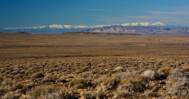
There was no private land or ranches until we reached the northern end. There we found irrigated hay fields and range land for cattle. The rest was sagebrush (not my favorite) and dirt and rock. (But I think my sinuses are finally getting acclimated to sage and juniper, after 3 weeks of living in it.)

The valley holds a 620 cache power trail; we did only 150 of them before we had to stop and just drive; even then, we didn't make it to Winnemucca until after dark. We did cache #620, just for fun.


Our day was bookended with a morning sunrise (with a surprise glimpse of snow on mountains), and an evening sunset.