Showing posts with label Shorelines. Show all posts

7.19.2019

Washington Park


We left a day early for a long weekend on Whidbey Island, for our niece's wedding. Time for exploring, and geocaching, and photography. Our favorite route to the Deception Pass bridge, the gateway to Whidbey, takes us across Fir Island in the middle of the Skagit Flats. with (usually) a detour to the small town of La Conner. I love this drive, past farms and farmhouses and barns, and in winter, thousands of snow geese and swans.


There's a back way out of La Conner that takes you over the natural waterway that separates Fidalgo from the mainland, then along Skagit Bay, the part of Puget Sound that runs east of Whidbey Island. There are beaches to walk, and beautiful views from this road.

Once on Fidalgo, you can explore Anacortes, or hop a ferry to the San Juan Islands, or take the 5-minute ferry crossing to Guemes Island (something we've never done, but plan to do this summer). Guemes is one of a handful of small islands just north of Whidbey Island; just east of but not part of the San Juans.

Or you can drive to the very western tip of Fidalgo, and go hiking in Washington Park. A lot of people choose to ignore the trails and walk on the narrow, windy road instead. Not a great idea, in my opinion. It is not fun to come around a steep, blind corner and encounter people and their dogs, spread out across the one-lane road. Just saying.

We were short on time today, so found parking above the nearly bare hillside on the south side of the park, overlooking Burrows Island (yep, more islands). We had several trails to choose from, and decided to take the shortest (and steepest) path. We made our way (carefully) down a rocky trail, following a woman who sat down right at the edge of the dropoff, and pulled out a sketch pad and watercolor paints. DW stopped for a photo, so I did the same. Look closely, and you'll see the faint rocky path that switchbacks down the hill. And in the distance, you can see Lopez Island, part of the San Juans.


It's a steep trail, a bit scary in places, but the reward was good: this beautiful rocky shoreline and crystal clear water to photograph. We were still about 30 feet above the actual rock shelf, but that was close enough for me.


7.05.2019

Share where you live... reflections

At the marina in Port Townsend, in between rain showers, the reflections were amazing.


Around the point near Fort Worden, the rain turned a depression in a boulder into a reflecting pool. But it was more fun to photograph leaves in the water, than lay on my stomach on the wet sand and try to catch a reflection of sky and clouds.


Caption: Play in the rain... find some puddle reflections

This is #8 on the @twistedroadstudio summer photography scavenger hunt

6.22.2019

Cache machine...

Up at 4:00 this morning, and on the road. Not out of town this time, just a day wandering around Monroe with a bunch of friends, finding geocaches.


From Monroe to the cliffs above Index, we spent the day walking and driving from one beautiful place to another. There is much I don't like about my birth state anymore, but I can't fault the scenic beauty.

On a back road, on the south side of the Snohomish River, we followed a trail down to a beach full of cliffs and boulders, and still clear water.

3.24.2019

In balance...


Back to the land of snow and cold for the weekend, with wine tasting, great food, and gardens bursting into bloom all around. The Olympics are a backdrop to Port Angeles, unmistakably still in the throes of winter.

My favorite view of the city is from here, Ediz Spit. From this narrow strip of land between the Strait and the harbor, you see how the city is shoehorned in between mountains and tides. I love that.


Ediz Spit is also home to a family of feral cats. The locals provide feed and water; there are shelters built among the rocks, with rugs and boxes to help keep them cozy.

Someone also comes here to build balanced rock sculptures. These are so cool... I never get tired of seeing them.


Every one different, and clever.

3.08.2019

Try sailing...

We sold the sailboat when we bought our little farm. Something had to give, and horses and building fences and mowing pastures won out over sailing.

When we walked in Coulon Park today and saw these little get-wet sailboats, it did make me think about sailing again. Maybe after a few lessons on a hot August day, we'd be ready for a small sailboat at our lakefront cabin.

Wouldn't that be fun?

3.02.2018

Hanging at the docks...

We've been spending time on the waterfront in Tacoma lately, a quiet place to find our daily geocache, and it's surprisingly interesting. Last week we saw four 300+ foot high cranes arrive by ship. Today, one of them is already installed on its new pier. We found a tiny hidden park, just a strip of walkway leading from road to waterway, with a tiny platform that faced south. With buildings right next door, we wondered about the placement. But when we walked down to the water's edge, I understood. The platform was much older than the structure next door; in years past, it would have had a bird's eye view of Mt. Rainier. The mountain was hiding today, but it was still a good view.

2.25.2018

Eye of the storm...

My niece told me about the ship bearing four new container cranes, due to arrive at the Port of Tacoma. And when we headed for the Port today, to do our daily geocache, I was hoping we'd get to see them. We drove into a thunderstorm, with black clouds and rain, but to the west the sun was shining on the Olympics. The wind was ice cold, and I wished I had brought my Nikon so I could have zoomed in on the ship. I can't imagine how this cargo, towering high above the deck, traveled all the way across the Pacific from China. The cranes, once installed, will be the biggest container cranes on the west coast: 434 feet tall with the booms raised.

10.26.2017

Penn Cove...

Coupeville is one of my favorite places on Whidbey Island. It's at the end of Penn Cove, famous for its mussels... and blue waters. The town was laid out in the 1850s, platted in 1910, and still has the look and feel of a 150-year-old seaport.


Every time we're here, I'm thankful that Coupeville is a historic district, and protected from rampant development. The town nestles within the first national historic reserve in the country, Ebey's Landing. It was established in 1978 by an act of Congress. Its 22 square miles includes farmlands, two state parks, shorelines and beaches, parks, trails, and 91 buildings and structures on the National Register of Historic Places.
We came early this morning for breakfast, then walked out onto the pier. There were kayakers out for a morning paddle, and a group of people were waiting to board a boat to go tour the mussel beds. 
We had a different goal: a geocache hidden in plain sight on the pier that was causing a lot of fellow cachers a lot of frustration. We found it, yeah! 
On the roof was a group of seagulls, squawking their heads off at something not to their liking. When we walked around behind the building, we saw why: A Great Blue Heron was perched on one end of the roof. Both species were keeping their distance, but it didn't matter. The seagulls were vocal in their dislike, but the heron stood alone and aloof.

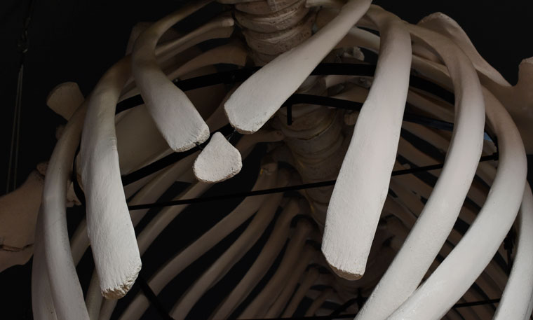
We walked inside to check out the displays and the complete whale skeleton that hangs from the ceiling.

And then we headed north toward the bridge, and home. 

I love this island, and would love to live here someday. If we ever do, I know I'll be spending a lot of time here, watching and waiting for photographs.

1.14.2017

Bits of me...


I can't walk on a beach without picking up a rock or bit of beach glass to bring home. Most people like sandy beaches that warm up in the sun, and feel good squished between their toes. I prefer rocky beaches with noisy surf, beaches where I can walk for hours looking for agates and jasper, or even pieces of old brick that have been scoured by the waves. Those are the beaches of my childhood, when my family spent every vacation on the Oregon coast, bringing home a bag full of rocks to run through the rock polisher. In my upstairs bathroom is a glass jar of those beautiful stones from my childhood... black and red, striped and heart-shaped, white quartz and agates of yellow and gold and copper.

1.06.2017

Waterfront...


A day on the Tacoma waterfront, exploring. From the Chihuly glass fountain, frozen in the 17-degree morning, to the grassy public spaces along Ruston Way, it was a morning to learn about the history of the old waterfront, long gone.


All day it was sunny and clear and cold, and I don't think I was warm all day. We ended the day in Lakewood for dinner and a beer with geocaching friends, old and new.

12.18.2016

Water into ice...


If the river has a soul, it's a peaceful one. If it has a lesson to impart, that lesson is patience. There will be drought, it says; there will be floods; the ice will form, the ice will melt; the water will flow and blend into the river's brackish mouth, then join the ocean... endlessly, forever, amen.  - Therese Anne Fowler

12.08.2016

A new view...


One of the reasons I love driving the back roads (other than driving my bright red MX-5 on a twisty road) is that I almost always find a different viewpoint of a local landmark. Like Mount Si, which rises above the little town of North Bend. It's a spectacular hunk of glacier-carved rock and one of my favorite views along I-90 heading toward Snoqualmie Pass.

But today we found a different view, with the mountain coated in fresh snow, the Snoqualmie River flowing north, and all of it framed with trees and shrubs still wearing their autumn colors.

12.30.2015

Basic black...


Ever since I watched my sister walk right across the Tahuya river one fall, I've wanted my own Bogs. Living on acreage with horses, I always had farm boots. Clunky, too-big, bone-chilling-cold rubber boots, that never lasted more than a couple of years. I wanted something better, so I can get down to our pond in the wet months, and go watch the salmon go up the rivers to spawn.

The short Bogs boots with the side hand grips are everywhere, even the local discount stores. But I guarantee this: any water I attempt to cross will be just over the bottom of those side openings, and my feet will get wet. No, I wanted the tall, knee-high boots with neoprene uppers for warmth.

And finally, I found the perfect pair at a local farm store. I had a choice between pink patchwork (not me), bright green cammo (I don't think so), or plain black.

Basic black is cammo enough for me.

11.27.2015

At the Point

We met the family for breakfast this morning, at one of Tom's favorite cafes on the Point. The rest of the family headed back to the States, but we're staying on a few days, so we can pick up the new kitten on our way home. We admired Val's paintings at the local gallery, then changed to warm clothes for a walk and some geocaching.


It was cold and icy again today, and it felt more like winter than autumn... a beautiful day for exploring. There were eagles everywhere today, and autumn leaves shining in the sun. The bright afternoon light was beautiful on Mount Baker and the North Cascades.

9.02.2013

Yakima Canyon in flood

This is one of my favorite places, and not just because the twisty road was made for my MX-5. I love the way the road hugs the river, and how the hills change from season to season. Whether covered with snow or with golden grass, they're equally beautiful. If we're lucky, we'll see eagles and hawks soaring on the air currents.

On a road trip through Idaho last May, we drove the canyon on the first day, and on the last. The river was high when we started our road trip, and was in flood when we came back because of back-to-back thunderstorms on the eastern slope of the Cascades (where the Yakima River has its origins).

Come fall, the water will drop and the river can be waded by fly fishermen. I'm looking forward to that. But for this one day in May, I loved seeing the canyon full of a rushing river.

Looking for snakes... and a geocache


There's an eagles nest in one of the pine trees along the river.


It's a short walk from the highway down to the cliffs.


That row of trees is currently on an island... it isn't supposed to be.


Flooded fields near Canyon Road, at the mouth of the canyon.

8.02.2010

Big Spring, Missouri


I smile every time I write this, or show someone the photos I took at this enormous spring, because the name is such an understatement.


It's the largest spring in Missouri, and one of the largest springs in the world. On average, it gushes forth 278 million gallons each day from three outlets along the base of a dolomite cliff. For those who don't want to pull out a calculator, that's 11.6 million gal/hour, and 193,000 gal/sec. The river it spawns is turquoise blue in color, and crystal clear. We came here to do an earthcache, but it was also an excuse to get away from the main highways and explore some back roads in the mountains, on our way through southern Missouri into Arkansas.


Like every day so far, today was hot and humid. So it was nice to be next to the river and spring, and in the shade of the trees.